Maps & Resources
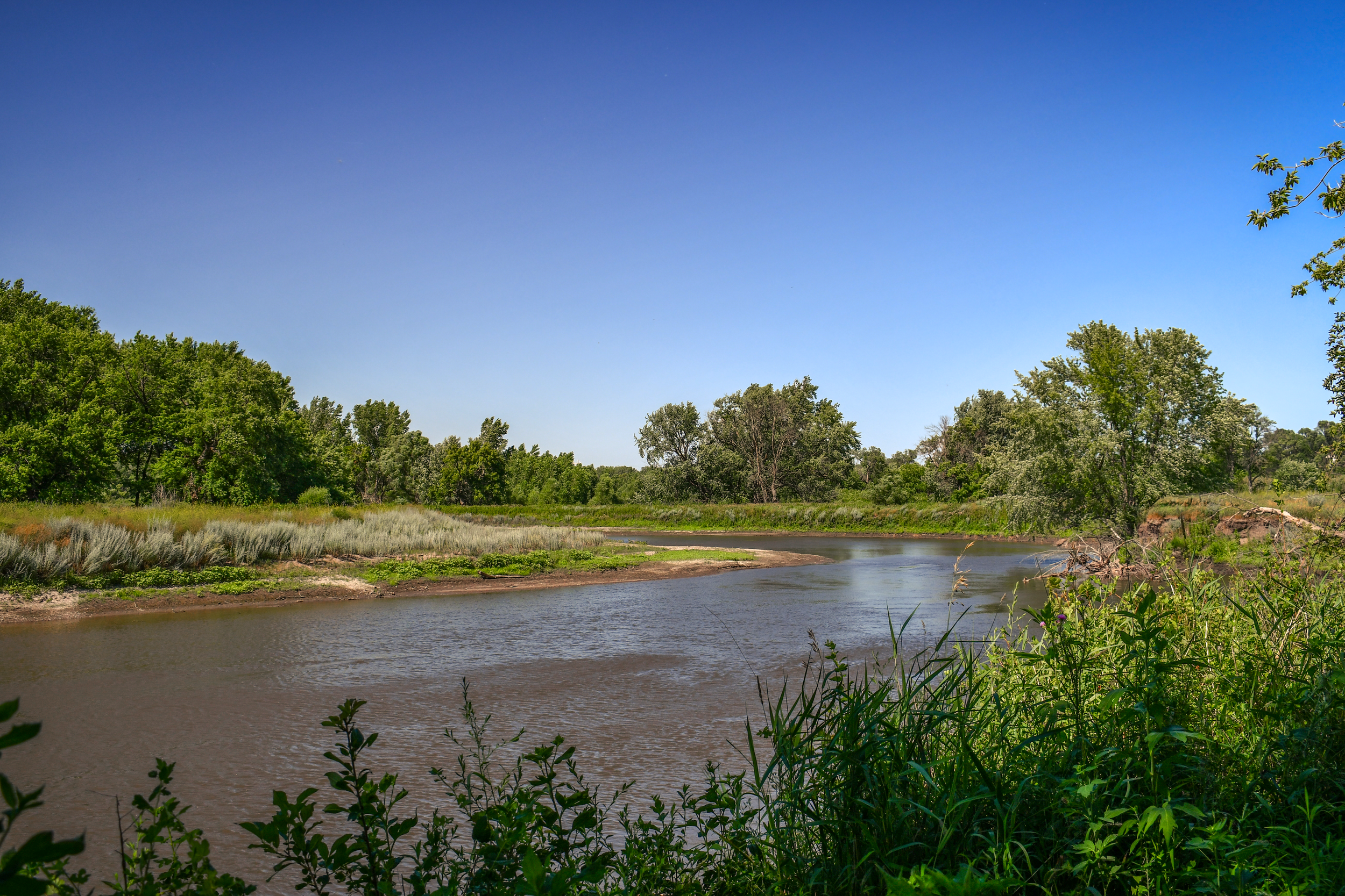
The Big Sioux River is a great place to play! As you head out into the wild, remember the principles of minimum environmental impact:
Plan ahead and prepare. Know your route to reduce your environmental footprint. Also, know the resources you need to avoid excess.
Dispose of waste properly. Make sure you use proper waste receptacles for all trash, including cigarette butts and toilet paper.
Do not use soap in freshwater streams.
Leave what you find, including shells, rocks, and driftwood.
Respect wildlife. Don’t disturb nests or remove animals from their homes.
Camp 200 feet or more from the water.
Do not cut trees or pick plants.
Remember to abide by all fishing, hunting, and trapping regulations.
The South Dakota Department of Game, Fish, & Parks website is a great resource for any questions you may have about your adventure plans. If you plan on fishing, make sure you check out Fish Consumption Advisories.
River Access and Recreation Maps

SD Game, Fish, and Parks Public Water Access
Navigate through various maps that provide information on public access to boat ramps, shore access, ice fishing, and more. Additionally, this application provides closure announcements and reports.

SD Game, Fish, and Parks Jay Heath Canoe & Kayak Trail
This application is designed to better assist canoers and kayakers navigating throughout the Big Sioux River Watershed. It includes launch sites, campgrounds, and information specific to each site.

SD Game, Fish, and Parks Non-Meandered Water Closures
This application provides information about closures, predominantly throughout the Eastern side of South Dakota, of non-meandered bodies of water. Non-meandered waters are private property.

SD Department of Agriculture and Natural Resources Measured Lakes Elevation
This application provides the location, historic elevation readings, and outlets for measured lakes within South Dakota.
Water Quality Maps

SD Department of Agriculture and Natural Resources Water Quality Monitoring Access Portal
Navigate through the map by clicking on lakes, streams, and rivers to view summary graphs of recent water quality data, projects, and reports. Dots on the map represent water quality monitoring stations that provide recent water data within specific parameters.

SD Department of Agriculture and Natural Resources Surface Water Quality Standards
Navigate through this map to discover the quality of lakes, streams, and rivers within South Dakota in accordance with the standards set by the EPA in the Clean Water Act.

Environmental Protection Agency How’s My Waterway?
This application provides information on the national scale for the EPA’s standards for water quality for recreational use, fish consumption, aquatic life, and drinking water. Search any address, zip code, or place to access information particular to your concerns.

Environmental Protection Agency ECHO
Maps and graphs compare air, drinking water, hazardous waste, pesticides, and wastewater environmental compliances and enforcement indicators on the state and national levels.

SD Department of Agriculture and Natural Resources Harmful Algal Blooms
Click on markers to access information about the microcystin levels of a waterbody. While microcystin can inform us if a waterbody is safe for recreational activities, such as swimming, kayaking, and canoeing, this map does not provide real-time information. It is a public record for algae or algal toxins.

SD Game, Fish, and Parks Aquatic Invasive Species List
Navigate this map by clicking on waterbodies and markers for lakes. This application provides a list of invasive fish, invasive plants, and invasive invertebrates for individual waterbodies.

The Nature Conservancy Resilient River Explorer
Explore the resiliency of any river within the continental United States. Learn about the interconnected relationship between aquatic and terrestrial environments in assessing water quality. Discover solutions to protect and restore our nation’s rivers.

SD Department of Health Fish Consumption Advisories
Navigate to different bodies of water to investigate current or recent levels of mercury in fish. Mercury bioaccumulates in fish and can pose a risk to human health when consumed.
Geographical and Geological Maps

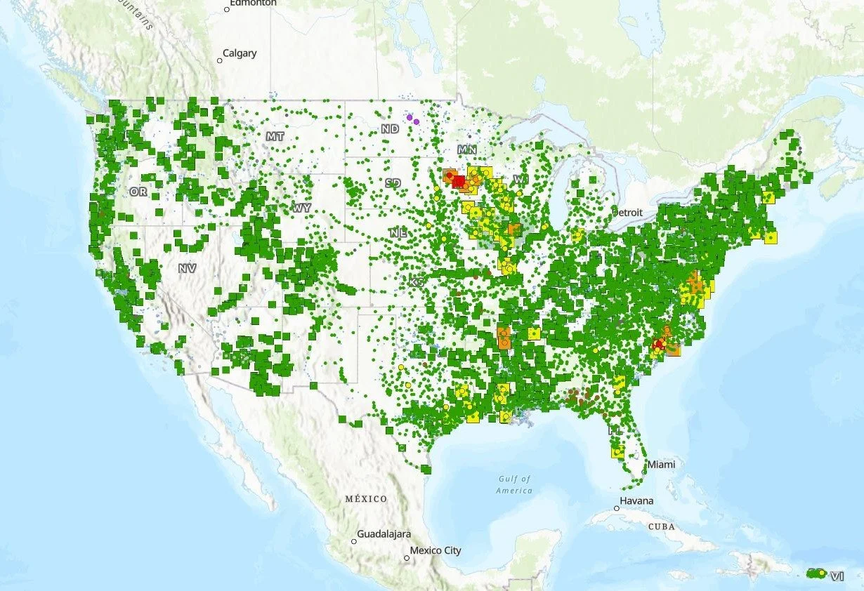
United States Geological Survey National Water Dashboard
This application provides real-time information on water levels, weather, and flood forecasts, as well as data for streams, lakes, reservoirs, precipitation, and groundwater from more than 13,500 USGS observation stations across the U.S.

SD Department of Agriculture and Natural Resources Big Sioux Flood Information
The South Dakota Flood Information System Map provides access to current stream conditions, flood forecasts, visualizations, inundation maps, and flood-related data information.

SD Game, Fish, and Parks Aquatic Habitat and Access Biologists
Get to know South Dakota’s regional Biologists, Grant Truskowski, Kyle Potter, Tony Quail, and Carter Knecht. Contact information available.

American Rivers Dam Removal Map
Application includes dams that have been removed across the country by American Rivers and other associations to restore free flowing waterbodies. While dams can be beneficial, the removal of dams becomes necessary when they begin to deteriorate, damage the ecosystem, and are no longer in use.

Emergency Contact Information
In the event of a flood emergency, always follow directions from local officials. If you or someone nearby is in immediate danger, call 911. For non-emergency assistance and shelter, use the American Red Cross Shelter Finder to locate open shelters in your area.
If your home or property has been damaged by flooding, you may be eligible for support through the National Flood Insurance Program (NFIP) or FEMA’s disaster assistance resources. It’s important to document damage with photos before beginning cleanup.
To stay informed, sign up for Wireless Emergency Alerts (WEA), which provide real-time text notifications from local authorities. You can also check your state or local emergency management office website for evacuation notices, road closures, and local updates.
For general questions and support, you can also call 211, a free helpline available in many areas that connects you to local resources and emergency services.

National Inventory of Dams: Dams of South Dakota
Navigate this map to learn more about South Dakota’s 2,599 dams. The site includes information about the material and size of each dam, its purpose, when they were built, and its last inspection date.

The Nature Conservancy Resilient Land Mapping Tool
Explore the resiliency of terrestrial ecosystems in the United States. Learn about the interconnected relationship between land resiliency and local biodiversity. Analyze different layers relating to carbon layers, habitat layers, conservation, and more.
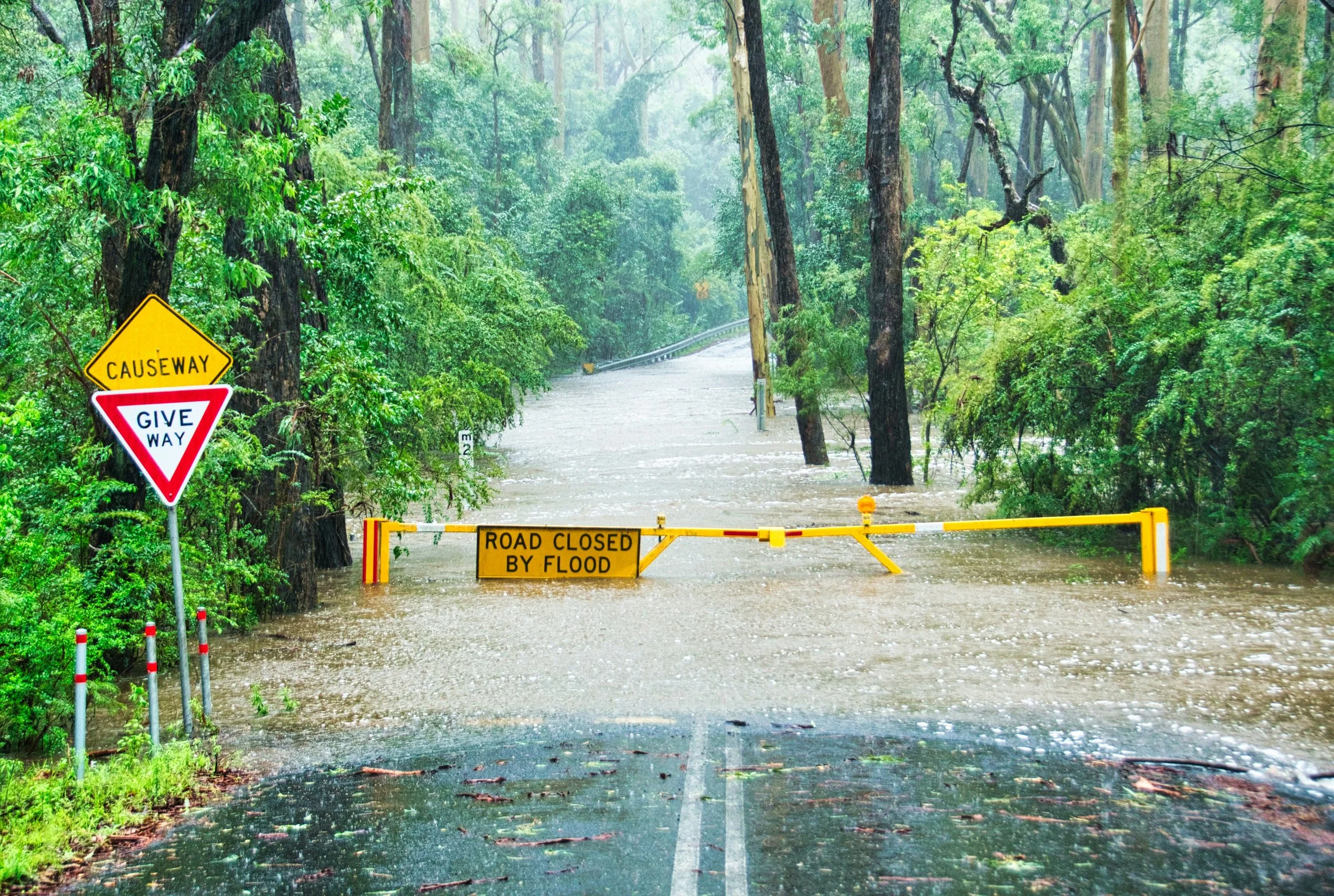
During the Flood: Stay Safe and Informed
Floodwaters can rise quickly and unpredictably. If authorities issue evacuation orders, follow them immediately and use recommended routes. Avoid walking or driving through flooded areas. Just six inches of moving water can knock you down, and a foot can sweep away most vehicles. Stay alert by signing up for local emergency alerts, and move to higher ground if you are in a low-lying area. If you must shelter in place, keep your emergency kit close and avoid contact with floodwater, which may contain debris, chemicals, or sewage.
For more information, refer to Ready.gov’s flood safety guide or the American Red Cross flood preparedness page.
PFAS Maps
Environmental Working Group PFAS Contamination in the U.S.
This application allows users to observe recent data regarding PFAS contamination in the U.S. PFAS, otherwise known as forever chemicals, are harmful pollutants that affect water quality and human health. The EWG collects system data nationwide and provides information regarding suspected sources, years detected, and the amount of contamination.
Flood Preparedness: What to Do Ahead of Time
The NOAA Flood Prediction Map displays real-time flood risk data across the U.S., using forecasts from the National Weather Service and FEMA to help communities understand and respond to potential threats. To stay prepared, individuals are encouraged to check their flood zone using FEMA’s official maps, assemble an emergency supply kit, develop a household evacuation plan, and consider flood insurance options through FloodSmart.gov.

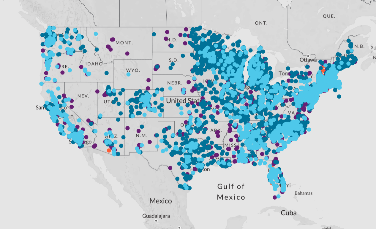
Environmental Working Group Suspected Industrial Discharges of PFAS
This application shows the locations of 41,828 industrial and municipal sites that are known to produce or use, are suspected of using, or a suspected source of PFAs. The sites are approximate, and the site does not claim to purport to show known discharge sites.

Environmental Working Group 720 Military Sites With Known or Suspected Discharges of PFAS
This application provides information on more than 700 U.S. military sites that are known or likely to have discharged PFAS. PFAS-based firefighting foam is a typical source, according to the Defense Department data compiled and mapped by EWG.
Flood Emergency Resources

After the Flood: Return Cautiously and Prioritize Safety
Only return to your home when local authorities confirm that it is safe. Avoid floodwater, which may be contaminated with sewage, oil, or chemicals, and could be electrically charged from downed power lines. Document all property damage with photos before beginning cleanup, as this is required for most insurance claims. Wear protective gear such as gloves and boots when cleaning, and use disinfectants to prevent mold and bacteria. Discard any food, water, or medicine that came into contact with floodwater. Be alert to signs of structural damage, gas leaks, and mold growth.
For more detailed instructions, refer to the CDC’s guide to staying safe after a flood and FEMA’s disaster recovery resources.